Lukomir — Bosnia's last highland village
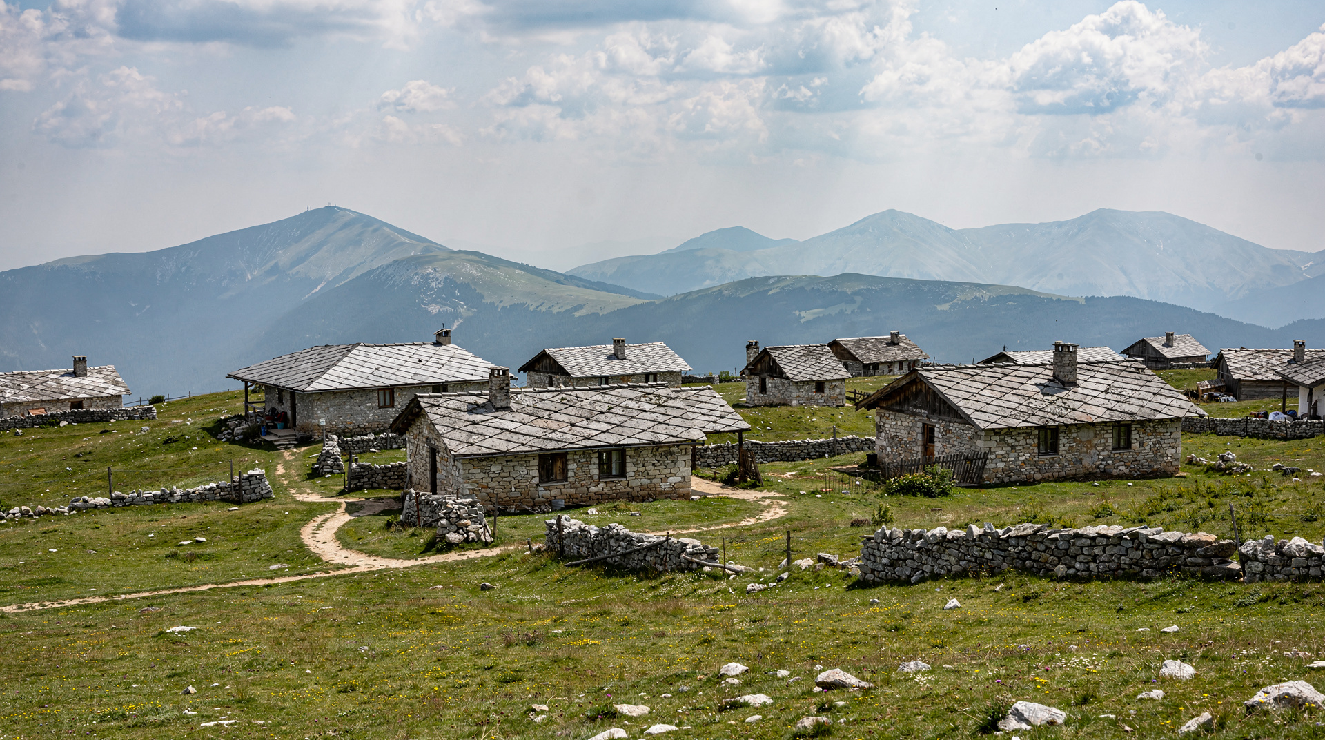
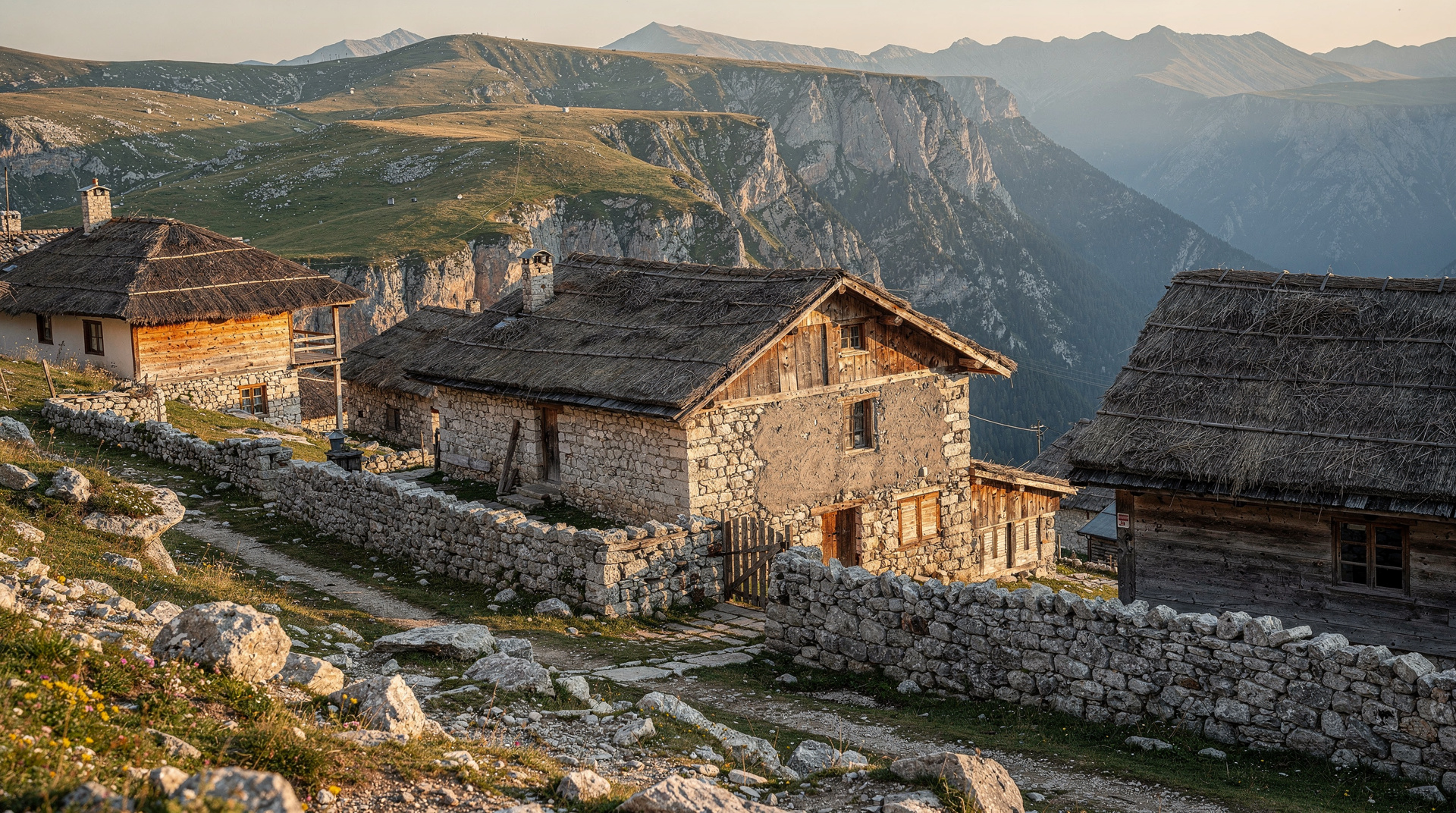
There is a village on the Bjelašnica plateau, 1,469 metres above sea level, where houses are still built of stone and wood in the pattern of medieval Bosnian architecture, where the old women wear traditional dress, and where the track from the nearest asphalt road takes a four-wheel drive vehicle in summer and nothing at all in deep winter.
Lukomir is often described as Bosnia’s last highland village. The description is not hyperbole.
| At a glance | |
|---|---|
| Where | Bjelašnica plateau, roughly 35km from Sarajevo |
| Cost | Free to walk in; guided hikes from Sarajevo typically cost around 40-60 EUR |
| Time needed | 5-6 hours round trip from Umoljani, or a full day from Sarajevo including transfer |
| Getting there | Own car/taxi to Umoljani, then hike; or a guided day hike that handles transport |
| Best time | June to October (see seasonality below) |
What makes it unusual
Most Bosnian highland villages were either abandoned during the war, slowly emptied by migration toward the cities, or modernised into functional but characterless settlements. Lukomir survived, and it retained something that most places have let go: a built environment and a way of life that connects directly to a pre-modern past.
The houses are low stone structures with steep wooden-shingle roofs. The lanes between them are unpaved. The edge of the village drops sharply into the Rakitnica canyon — one of Bosnia’s deepest gorges, 400 to 600 metres of sheer limestone wall below the plateau edge.
The permanent population in winter is very small — estimates vary, but somewhere between a few dozen people and fewer. Older residents stay year-round; the younger generation commutes or has moved to Sarajevo. In summer, the village fills slightly with returnees and a small number of visitors.
Getting there: the hike
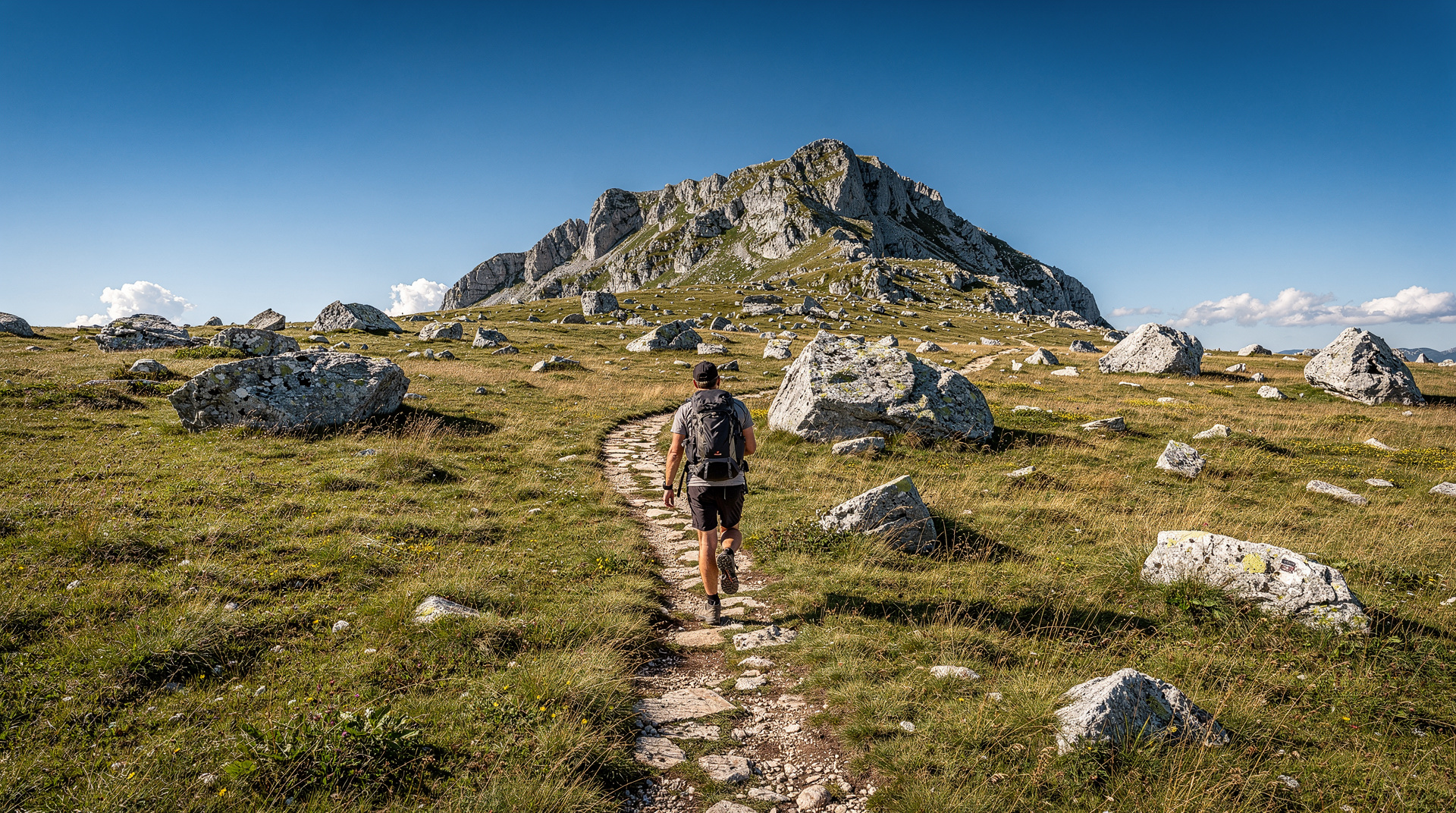
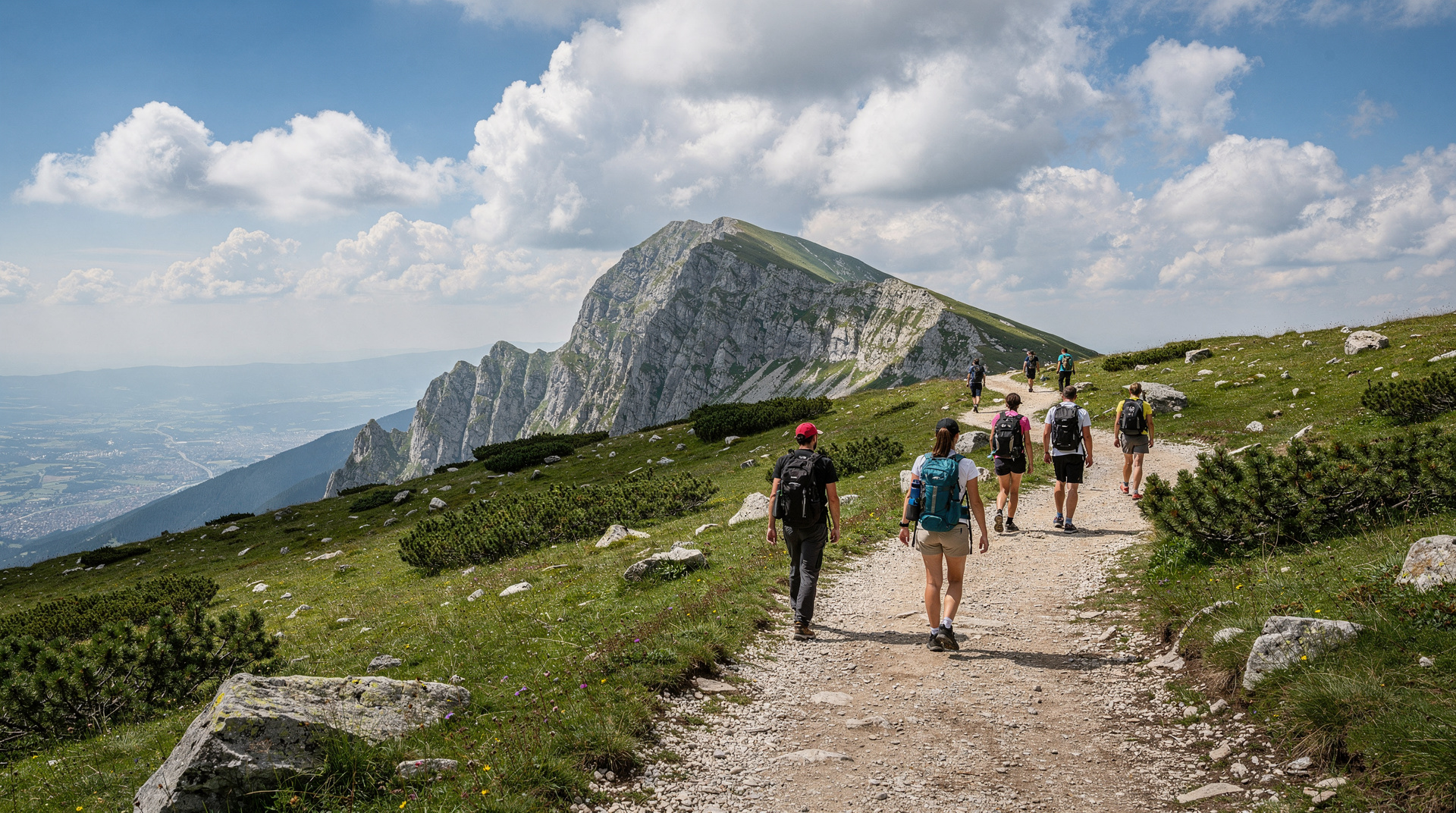
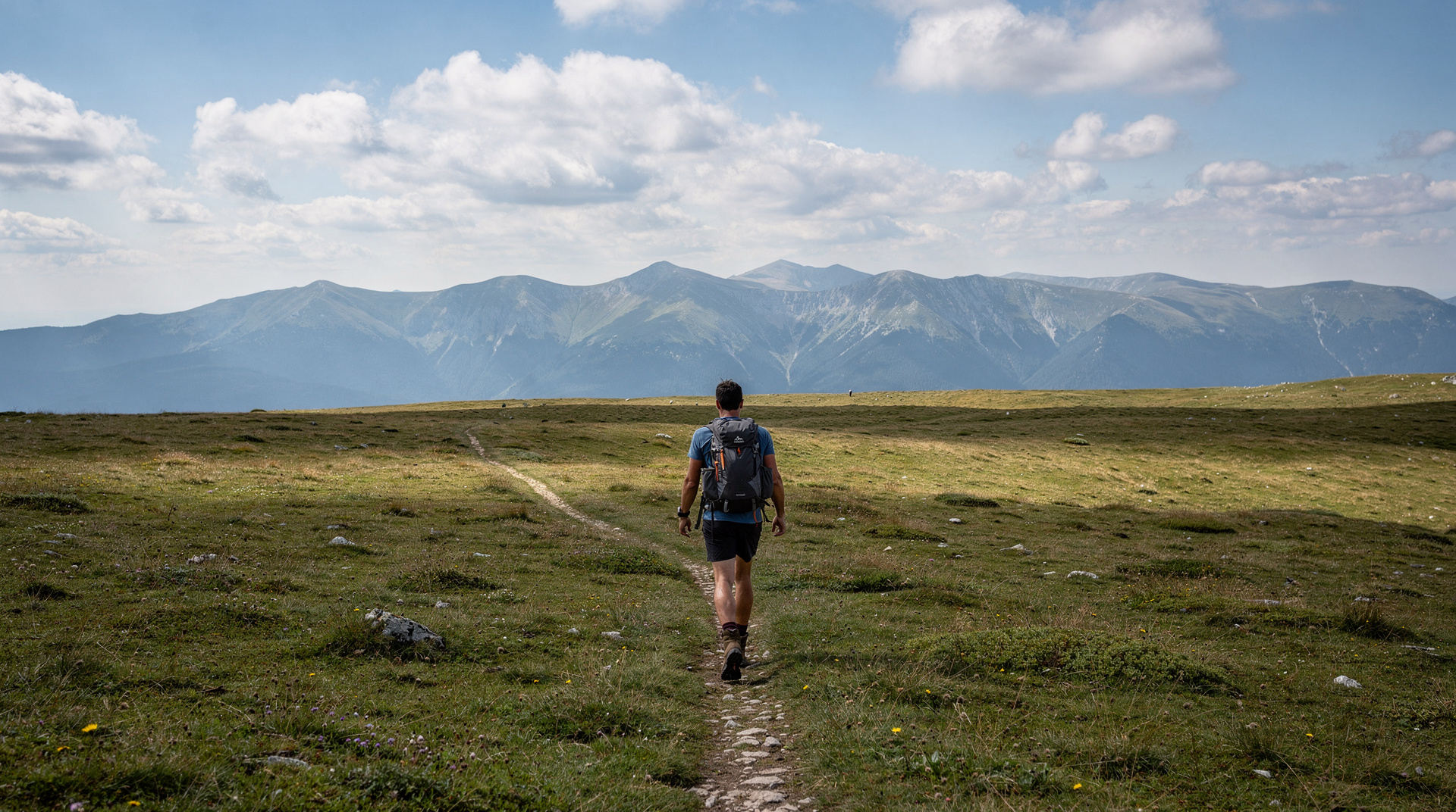
The standard approach is on foot from Umoljani village, roughly 6 kilometres away along a trail that crosses the Bjelašnica plateau. The walk takes two to three hours one way — allow five to six hours round trip with time in the village.
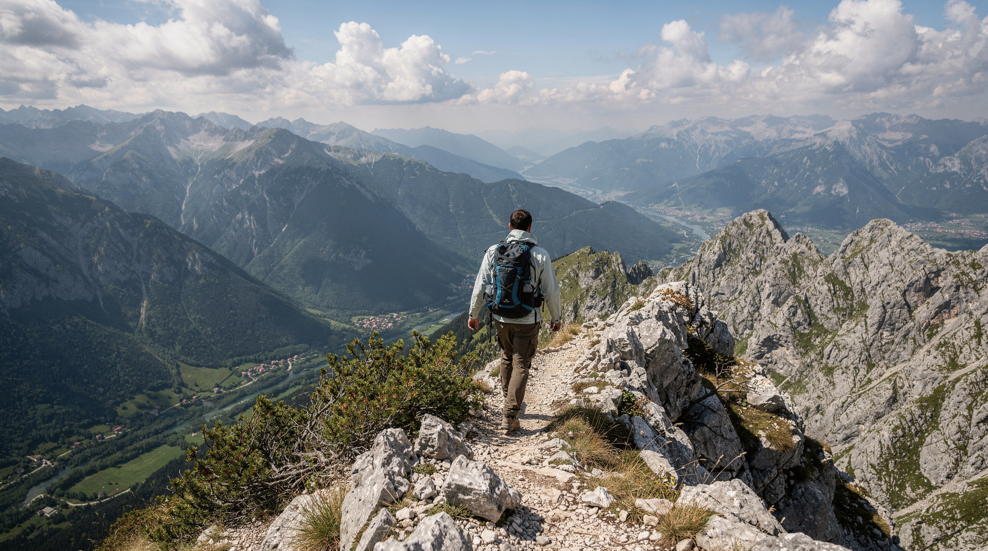
The trail is well-marked and follows the plateau ridgeline, with increasingly dramatic views north over the Sarajevo valley and south into the Rakitnica canyon. The final approach to the village comes over a ridge, and the first sight of the stone buildings against the plateau grass is genuinely striking.
A full-day guided hike to Lukomir from Sarajevo is the most convenient option, particularly for first-time visitors — the guide provides historical context and ensures you find the trail correctly (it is not difficult but it is remote enough that navigation matters).
The Lukomir hiking guide covers the trail approach, difficulty, and what to bring in detail.
The view
The Rakitnica canyon is visible from the village edge: a vertical drop of several hundred metres to the river below, the canyon walls in grey limestone streaked with darker mineral lines. In summer, the canyon is green from the trees that colonise the lower slopes. In autumn, those trees turn.
The view east from the plateau ridge encompasses the full Sarajevo valley — the city is visible on clear days, the Olympic mountains on both sides — and on very clear days, the distant peaks of the Dinaric Alps to the west.
This is some of the best mountain scenery in Bosnia. The Via Dinarica long-distance trail passes through this region, and the section across Bjelašnica toward Lukomir is among its most rewarding sections.
When to go
June to October is the accessible season. The plateau can be snowed under from November through May, and conditions are unpredictable even in shoulder months. June brings the alpine meadows at full green, with wildflowers across the plateau. September and October have the advantage of autumn colours in the canyon below and reliably clear visibility.
July and August see the most visitors — guided groups from Sarajevo, individual hikers, and a trickle of overlanders. Still not crowded by any normal measure, but busier than other months.
Winter: The village is isolated. The plateau track is not passable without a snowcat or ski touring gear. For experienced ski tourers, the Bjelašnica-Lukomir circuit is a genuine winter objective — but this is not a casual outing.
| Month | Conditions | Crowds |
|---|---|---|
| June | Meadows green, wildflowers, occasional lingering snow patches | Low-moderate |
| July-August | Warm, driest trail conditions | Highest of the year, still uncrowded |
| September-October | Cooler, autumn colour in Rakitnica canyon, clearest air | Low |
| November-May | Plateau often snowed in, track unreliable or impassable | Near-empty (experienced winter hikers only) |
The guide to avoiding crowds in Bosnia has more on timing hikes like this one outside peak weekends. For a broader seasonal picture, the Bosnia in summer and Bosnia in autumn guides cover what else is worth combining with a Lukomir trip in each season.
What to bring
There is no shop, café, or reliable phone signal for most of the route. Carry more water than feels necessary — the plateau has little shade and the walk is exposed. Sturdy footwear matters: the trail is uneven limestone and packed earth, and the final descent into the village can be slippery after rain. A light rain layer is worth carrying even on a clear morning, since weather on an exposed plateau at 1,400+ metres changes faster than in the Sarajevo valley below. Cash (small BAM notes) is useful if you want to buy wool goods from the village women, since there is no card payment.
What to do in the village
Lukomir is not a tourist attraction in the conventional sense. There is no café, no visitor centre, no admission charge. You walk in, walk around the lanes, look at the buildings, talk to anyone who wants to talk (a few residents are accustomed to visitors and sometimes welcoming), and walk out again.
The only commercial transaction usually available is buying homemade wool products from the older women of the village — woven socks, mittens, and other items made from the wool of the sheep that graze on the plateau. These are genuine handicrafts and good souvenirs. The women do not pressure; they simply have items available.
A respectful visit means not entering private buildings, not photographing people without permission, and not treating the village as a performance. The people who live here live here.
Combining with Bjelašnica
Bjelašnica hosted the 1984 Olympic men’s downhill events. The ski infrastructure is still there — and still operating in winter. In summer, the mountain is a hiking base. The combination of Bjelašnica’s accessible tracks and the Lukomir hike as a longer objective makes a good two-day mountain trip from Sarajevo.
The Bjelašnica hiking guide covers the mountain’s summer trail network.
Fitting Lukomir into a wider trip
Lukomir works best as the mountain chapter of a longer stay based in Sarajevo. Travellers who want a second hike in the same region can compare it with the other routes in best day hikes from Sarajevo, and those who prefer a wider overview of walking in the country will find it in the hiking in Bosnia guide.
If you are planning the whole journey, the Bosnia 7-day itinerary and the Bosnia adventure itinerary show where a mountain day fits between the city and the rest of the country. The Lukomir village destination page gathers the practical background in one place, and the Sarajevo day trips guide is useful if you are weighing the hike against other excursions.
Getting to the trailhead is the part most visitors underestimate. The getting around Bosnia guide and the notes on driving in Bosnia explain what to expect from mountain roads, and the car rental guide is worth reading if you would rather not depend on a transfer. Anyone walking off the main paths anywhere in the country should also read the landmine safety guide and stay on marked routes.
For a longer walk in the same spirit, the Via Dinarica diary shows what several days on the trail feel like, and Sutjeska in autumn offers a different mountain landscape for another season.
Choosing how to get there
Three approaches work, and the right one depends on how much of the walk you want. Hikers who like the plateau crossing on foot can join a small-group full-day hike around the Bjelašnica plateau, which keeps the pace social and the logistics handled. Anyone who wants to see the village but spare their legs the long exposed stretch can look at a private four-wheel-drive trip from Sarajevo, which uses the summer track mentioned above.
Whichever you pick, the village itself rewards slowing down. The 4x4 and quad tours guide compares the motorised options, while the Lukomir hiking guide remains the better starting point for those walking independently. If you are still deciding whether the effort fits your trip, the Sarajevo day trips guide puts Lukomir next to the alternatives.
The honest note on “authenticity”
Lukomir is often described in travel writing as “authentic” — sometimes in a way that edges toward treating poverty and isolation as aesthetic amenities for visitors. That is worth pushing back on.
The people who live in Lukomir year-round face genuine challenges: limited services, difficult access, the slow erosion of a community as younger residents leave. The village is not preserved for visitors. It persists in spite of the obstacles, because it is home.
Visit with that in mind. The Rakitnica canyon and the plateau views are extraordinary. So is the chance to see a place that has held its character against all incentives to let it go. Both of those things can be true without the visit becoming extractive.
Frequently asked questions about Lukomir — Bosnia’s last highland village
Is Lukomir difficult to reach without a guide? No — the trail from Umoljani is well-marked and manageable for anyone with moderate fitness, though a guide adds context and removes any navigation uncertainty on a remote plateau with patchy phone signal.
Can you stay overnight in Lukomir? A handful of simple guesthouses operate in the village in summer, though options are limited and best arranged in advance through a Sarajevo-based operator rather than assumed on arrival.
Top experiences
Bookable activities with verified prices and instant confirmation on GetYourGuide.