Zelengora mountain lakes guide
Private Tour from Sarajevo: Sutjeska National Park
What are the Zelengora mountain lakes in Bosnia?
Zelengora is a mountain massif in Sutjeska National Park with a chain of glacial lakes scattered across a high plateau at 1,600-1,900m — Donje Bare, Gornje Bare, Orlovačko jezero and others. A 2-3 day traverse of the plateau is one of Bosnia's finest mountain lake hikes, with camping by the lakes and extensive ridge views.
If Trnovačko Lake is Bosnia’s most photogenic single spot, Zelengora is its finest mountain plateau — a long massif in Sutjeska National Park whose high-altitude grasslands hold a chain of glacial lakes that make it one of the most rewarding multi-day hiking destinations in the western Balkans. Far less visited than the Alps or Tatras, but comparable in beauty.
At a glance
| Where | Zelengora massif, Sutjeska National Park, southeastern Bosnia |
| Cost | Tjentište campsite around 15-25 BAM per pitch; wild camping on the plateau is free |
| Time needed | 2-3 days for the standard lake traverse; a strenuous day hike reaches the lower lakes only |
| Getting there | Self-drive around 3 hours from Sarajevo via Foča to Tjentište, or a guided multi-day tour |
| Best time | July to early September; late June can still have snow patches and boggy trails |
Zelengora: the green mountain
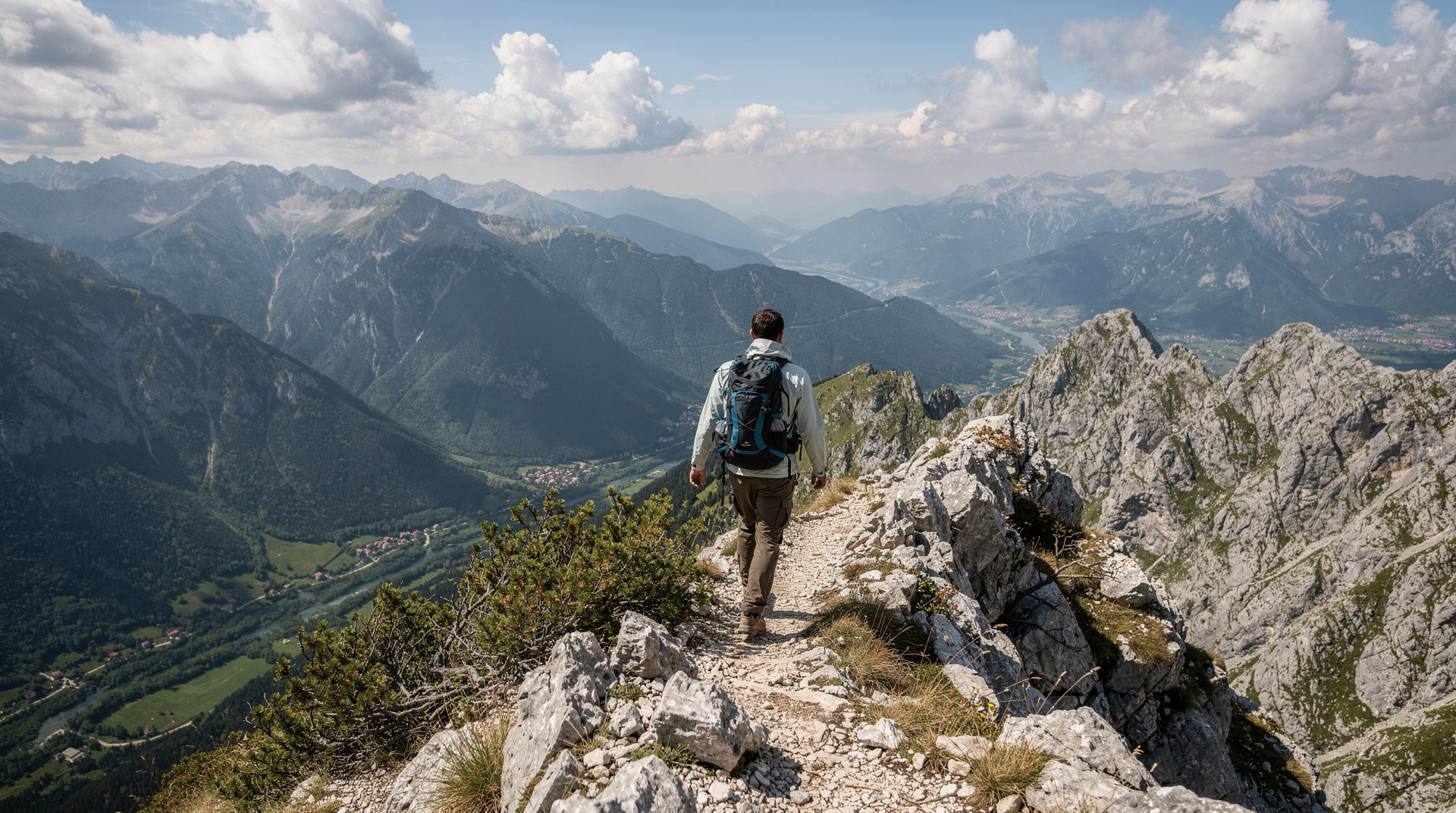
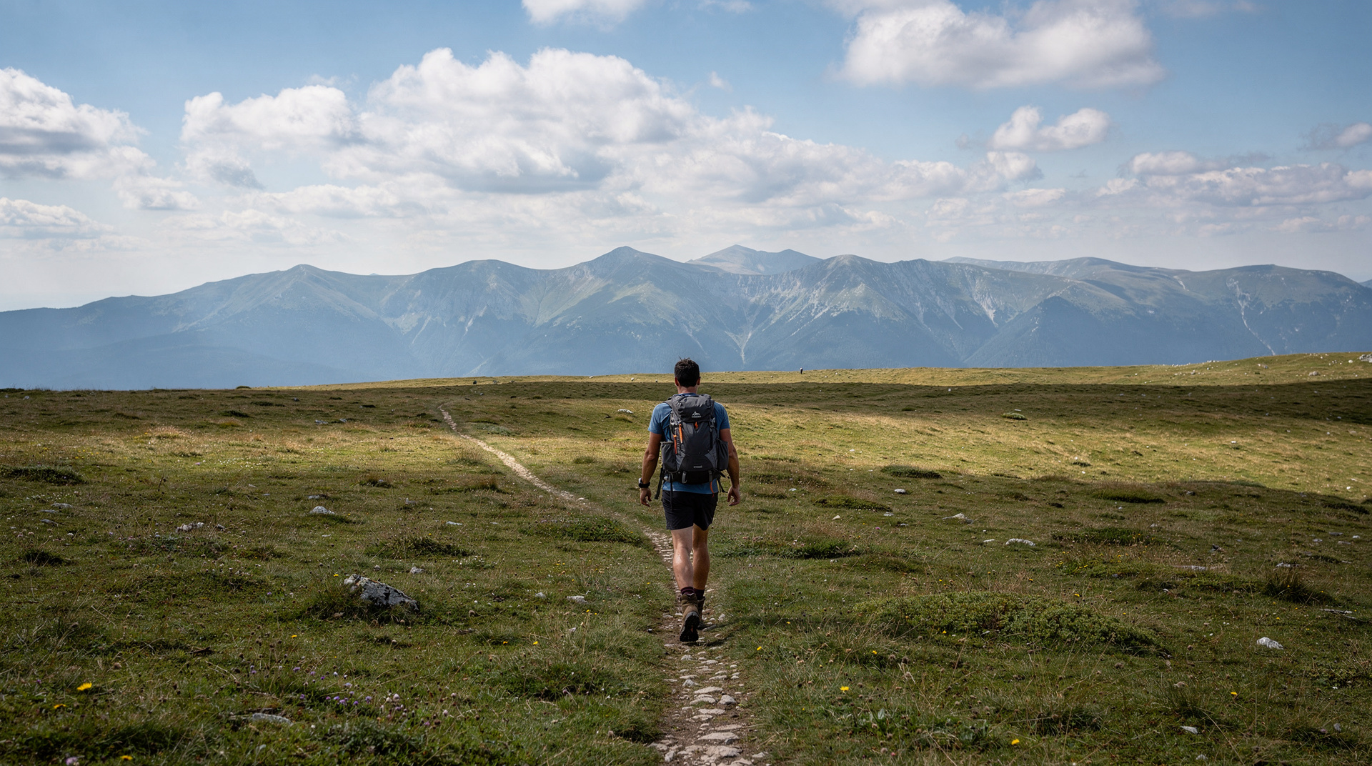
The name Zelengora translates as “green mountain” — a name that fits the massif’s character perfectly. Unlike the grey limestone ridges of Prenj to the north, Zelengora’s plateau is covered in alpine grassland, heather and wildflowers above the treeline, with dark-water glacial lakes filling the hollows. In July, the plateau is intensely green and flecked with colour; in September, it turns gold.
The massif runs roughly east-west for about 30 km, reaching 1,912m at its highest point. The main hiking interest lies in the upper plateau between 1,600m and 1,900m, where the lakes are concentrated and the views extend to Maglić and the Tara canyon to the south.
The main lakes
Donje Bare (lower lake)
The first and largest lake encountered on the standard approach from Tjentište. Donje Bare sits at approximately 1,670m in a broad, open valley. The lake is approximately 400m long and 200m wide, with grassy shores and views back toward the park valley. This is the most popular camping spot on the plateau — flat ground, accessible water and enough shelter from the wind for basic camps.
Gornje Bare (upper lake)
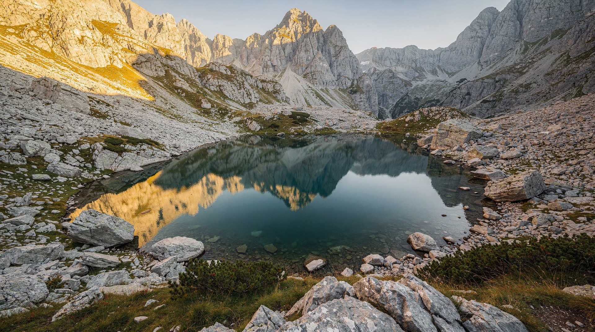
A shorter hike above Donje Bare, Gornje Bare is smaller and higher, at approximately 1,800m. The setting is more dramatic — the lake sits in a shallow cirque with steep slopes on three sides. On clear mornings the water reflects the surrounding ridges perfectly.
Orlovačko jezero
The most dramatic of the Zelengora lakes, Orlovačko jezero (Eagle Lake) sits at approximately 1,770m in a narrow elongated form. The surrounding cliffs are steeper than at the other lakes, giving it a more enclosed and atmospheric quality. This is the lake that most photographers who know Zelengora tend to gravitate toward.
Smaller tarns
Scattered across the plateau are several smaller unnamed pools and seasonal ponds. In early July after snowmelt, these temporarily expand into additional lakes, making the plateau extraordinarily waterlogged but visually spectacular.
The Zelengora traverse
The classic Zelengora multi-day route traverses the plateau from north to south (or reverse), linking the main lakes and ridge sections.
Suggested 3-day itinerary:
Day 1: Tjentište to Donje Bare (5-6 hours, 850m ascent) Start early from Tjentište, cross the forest belt and emerge on the plateau mid-afternoon. Camp at Donje Bare. 14 km.
Day 2: Donje Bare plateau loop (4-5 hours) Day hike from camp to Gornje Bare, Orlovačko jezero and return. Or continue along the ridge toward the eastern sections. Time to swim, photograph and explore.
Day 3: Return to Tjentište (4-5 hours) or continue to Kalinovik exit point
For those who want the traverse in full, an experienced mountain guide is strongly recommended for the less-marked eastern sections.
Guided options from Sarajevo
Private guided tour of Sutjeska National Park from Sarajevo provides the most flexible access to Zelengora, Tjentište and the wider park. This can be arranged as a day trip to the lower Zelengora approach or a multi-day expedition.
For those who want to combine Zelengora with the Maglić-Trnovačko Lake area, plan two separate days based at Tjentište — the two destinations are on opposite sides of the park and not practically combined in a single day.
Hikers who would rather spend their energy on the mountain than on logistics can also look at a guided trekking day in the Maglić and Trnovačko Lake area of the park, which pairs well with a separate day on the Zelengora plateau.
Zelengora in the Via Dinarica
Zelengora forms a key section of the Via Dinarica White Trail through Bosnia. Trekkers on the full trail approach from the north (Visočica), cross the Zelengora plateau, then descend toward Sutjeska and the connection to Maglić. This multi-day connection through Zelengora is the quietest and most authentically remote section of the Bosnia Via Dinarica.
Wildlife on Zelengora
The Sutjeska National Park wildlife extends to Zelengora’s plateau:
Brown bears (Ursus arctos): Present in the park but rarely seen from trails. Bear encounters are possible — standard protocol applies: make noise while hiking, carry bear spray if available, do not leave food out at camp.
Wolves: Active in the park but extremely shy of humans.
Golden eagles: Regular overhead on the plateau, scanning for marmots.
Marmots: Common on the rocky upper slopes, their alarm calls a constant soundtrack on the ridge.
Alpine flowers: Gentians, edelweiss, mountain pansies and various orchid species carpet the plateau in June-July.
Practical information
Getting there
- By car: Tjentište is 150 km from Sarajevo via Foča. Allow 3 hours. Park at Tjentište.
- No public transport: Bus connections exist to Foča (30 km from Tjentište) but no onward service.
- Guided tour: Recommended for first-time visitors to the park.
Accommodation
- Tjentište campsite: 15-25 BAM (8-13 EUR) per pitch
- Dom na Tjentištu hotel: 70-120 BAM (35-60 EUR) per person
- Wild camping on plateau: Permitted away from lakeshores
What to bring for Zelengora
- Tent (essential for multi-day)
- Sleeping bag rated to 5°C minimum (plateau nights are cold even in August)
- Water filter or purification tablets (lake water is clean but treat as precaution)
- Stove and fuel (cooking on the plateau)
- Trekking poles
- Warm layers and waterproof jacket
- Navigation: GPS with downloaded track, 1:25,000 map
Landmine safety
The Zelengora plateau is within an area affected by wartime activity. Follow the same protocols as across Bosnia’s mountains:
- Use only marked trails and GPS-tracked routes from official sources
- Do not deviate from the trail, particularly on the plateau margins and in valley areas
- Park rangers at Tjentište can advise on current conditions
Combining Zelengora with the rest of Sutjeska
A well-planned three-day Sutjeska visit can cover:
- Day 1: Maglić summit and Trnovačko Lake
- Day 2-3: Zelengora plateau traverse
This combination gives a comprehensive picture of Sutjeska National Park’s extraordinary range — Bosnia’s highest peak, its most photogenic lake and its finest mountain plateau, all within the same protected area.
Zelengora rewards multi-day commitment. Those who arrive at Donje Bare on a clear July evening, camp by the lake, watch the light change on the ridges, and wake to the silence of the plateau at dawn, invariably describe it as one of their best travel experiences in Europe.
Zelengora by season
| Month | Conditions | Crowds |
|---|---|---|
| June | Snow patches possible above 1,700m, boggy plateau, cold nights | Very quiet |
| July | Best conditions — dry trails, green plateau, wildflowers | Moderate, mostly weekends |
| August | Warm, reliable weather, occasional afternoon storms | Busiest month |
| September | Golden colours, cooler nights, generally stable weather | Quiet, good for solitude |
| October onward | Early snow possible, most facilities closed | Not recommended without experience |
Planning the trip around the weather
Mountain weather on a high plateau changes faster than the forecast for the valley suggests. A clear morning can turn into an afternoon of cloud and wind, and the open grassland offers little shelter. Start walking early, keep the exposed ridge sections for the best part of the day, and keep a margin in your schedule so a bad afternoon never forces a rushed descent. The best time to visit Bosnia page explains the broader seasonal pattern, while Bosnia in summer and Bosnia in autumn show what to expect lower down on either side of the hiking season.
If you want the plateau at its quietest, the shoulder weeks are the answer. The blog post on autumn colours in Sutjeska gives a sense of why early autumn is so rewarding, and the avoiding crowds in Bosnia guide covers the same logic for the rest of the country.
Reaching the trailhead without stress
The approach to Tjentište is part of the experience, and it is worth treating as a proper travel day rather than something to squeeze in. Read the renting a car in Bosnia guide before you collect a vehicle, and the getting around Bosnia guide if you are still weighing buses, taxis and a hire car. Arriving from the coast is possible too: the Dubrovnik to Sarajevo route passes through the same part of the country. Fly in? The Sarajevo airport guide covers the first hours on the ground.
Pack your food and fuel before leaving the larger towns, since the plateau itself has no shops. Fill your water containers at the start and treat what you collect from the lakes. Tell someone at your accommodation which route you plan to take and when you expect to be back.
Walking etiquette and leaving no trace
The plateau is a protected landscape inside a national park, and its appeal depends on how lightly each visitor treats it. Carry out everything you carry in, including food scraps and used tissue. Keep to existing paths across the wet grassland so that new tracks do not form, wash well away from the water, and keep stoves clear of dry grass. Quiet matters as well: wildlife stays further from loud groups, and other campers came for the silence.
The neighbouring Perućica primeval forest guide shows how seriously the park treats its most fragile areas, and the Sutjeska National Park destination page places the whole protected area in context.
What to expect physically
The walk up from the valley floor is steady and sustained rather than technical, and the reward comes when the forest opens onto the grassland. Walkers who are used to day hikes will notice that carrying a tent, stove and food changes the effort considerably, so test your pack on a shorter outing first. The best day hikes from Sarajevo and the Bjelašnica hiking guide are good places to build fitness and check your boots. For a full-day village walk at altitude, the Lukomir village hike guide is another useful rehearsal.
Poles help on the descent, and blister care belongs in every pack. Eat small amounts regularly rather than waiting for hunger, and drink before you feel thirsty. If a member of the group is struggling, shorten the day: the lakes will still be there tomorrow.
Where to go next
After the plateau, there are several natural next steps. If you want a lower-effort day out, a small-group full-day hike to Lukomir village from Sarajevo keeps you in the mountains without the camping commitment. The Prenj mountain guide describes a very different, rockier range, and the Tara river rafting guide offers a lively change of pace after days on foot. Anyone planning a longer mountain-focused trip can build on the Bosnia adventure itinerary, and for first-hand accounts of the long-distance route that crosses this massif, read the Via Dinarica thru-hike diary. Newcomers who want a broader overview of the country can start with the Bosnia travel guide, and those thinking about the legacy of the war in this region can read the landmine safety guide before setting out.
Getting ready before you go
Before committing to a multi-day traverse, check the hiking in Bosnia guide for general trail etiquette and gear norms, and confirm your fitness against the Maglić mountain climb guide if you’re considering combining both peaks. Drivers heading to Tjentište should also read the driving in Bosnia guide for what to expect on the Foča road, and anyone unsure about safety more broadly can check is Bosnia safe. For a shorter, single-lake alternative nearby, see the Trnovačko Lake hike guide.
Frequently asked questions about Zelengora mountain lakes
How do I get to Zelengora from Sarajevo?
Can I visit Zelengora as a day trip?
What are the main lakes on Zelengora?
Is Zelengora harder or easier than Maglić?
Can I camp on Zelengora?
Is Zelengora safe from landmines?
What is the best month to hike Zelengora?
Do I need a guide to hike Zelengora?
Top experiences
Bookable activities with verified prices and instant confirmation on GetYourGuide.